2014
SD2392 : Settlement at The Hawk
taken 10 years ago, near to Hoses, Cumbria, England
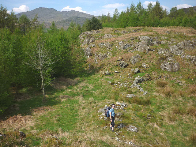
Settlement at The Hawk
Although sited on a promontory, the settlement appears to occupy a hollow amongst the rocky outcrops. This is the extreme western end of the few visible remains. Just beyond Ali is what appears to be an entrance in a wall which runs across a gap in the outcrops. It could be a Romano-British site. I wonder what they did for water? It's a fair way down to the becks on either side. The trees of course are a much later addition to the scene although the view to Caw cannot have changed much in the intervening centuries.
 Map © Crown Copyright")
TIP: Click the map for more Large scale mapping
- Grid Square
- SD2392, 11 images (more nearby 🔍)
- Photographer
- Karl and Ali (more nearby)
- Date Taken
- Monday, 21 April, 2014 (more nearby)
- Submitted
- Friday, 25 April, 2014
- Subject Location
-
OSGB36:
 SD 2399 9225 [10m precision]
WGS84: 54:19.2089N 3:10.2036W - Camera Location
-
OSGB36: SD 2399 9225
- View Direction
- NORTH (about 0 degrees)