2014
SE2551 : Stile near Shawfield Head
taken 10 years ago, near to Beckwithshaw, North Yorkshire, England
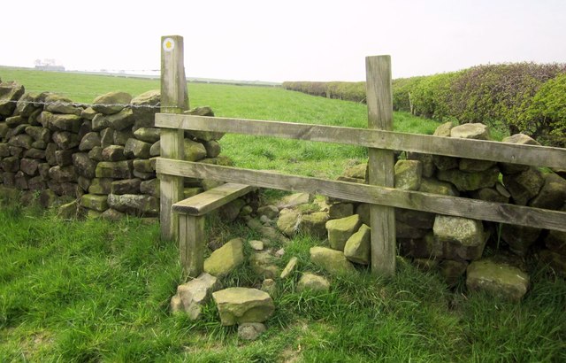
Stile near Shawfield Head
The field boundary crossed by the stile is the parish boundary between North Rigton (this Side) and Stainburn, so footpath 15 101/1/1 turns into 15 123/23/1 on the other side.
 Map © Crown Copyright")
TIP: Click the map for more Large scale mapping
- Grid Square
- SE2551, 31 images (more nearby 🔍)
- Photographer
- Derek Harper (more nearby)
- Date Taken
- Monday, 21 April, 2014 (more nearby)
- Submitted
- Friday, 25 April, 2014
- Subject Location
-
OSGB36:
 SE 2587 5150 [10m precision]
WGS84: 53:57.5367N 1:36.4334W - Camera Location
-
OSGB36: SE 2587 5150
- View Direction
- WEST (about 270 degrees)