2014
TF3792 : Leaning pillar of Mancroft
taken 10 years ago, near to North Cockerington, Lincolnshire, England
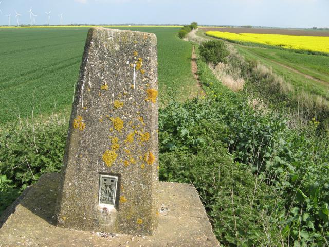
Leaning pillar of Mancroft
A close-up view of the drunken triangulation pillar (flush bracket no. S2612) and the astonishingly flat kingdom that it commands. Still no idea where the OS name of Mancroft came from.
 Map © Crown Copyright")
TIP: Click the map for more Large scale mapping
- Grid Square
- TF3792, 65 images (more nearby 🔍)
- Photographer
- Jonathan Wilkins (more nearby)
- Date Taken
- Wednesday, 23 April, 2014 (more nearby)
- Submitted
- Wednesday, 14 May, 2014
- Subject Location
-
OSGB36:
 TF 3799 9226 [10m precision]
WGS84: 53:24.5470N 0:4.4667E - Camera Location
-
OSGB36: TF 3799 9226
- View Direction
- Northeast (about 45 degrees)