SJ7579 : A Bachelor Group of Red Deer at Tatton Park
taken 10 years ago, near to Knutsford, Cheshire East, England
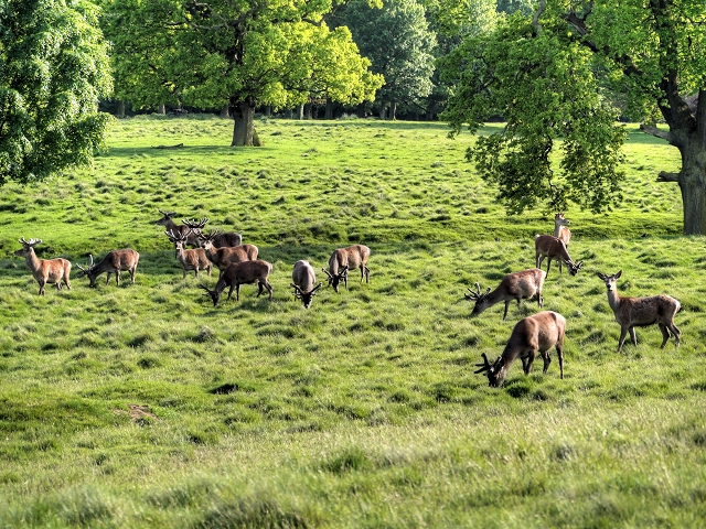
At this time of year, the deer have cast their antlers and the new ones, with their velvety covering, are beginning to grow in preparation for the autumn rutting season. Spring is also the time that the deer moult into their superb summer coats.
Tatton Park is a historic estate in Cheshire, to the north of the town of Knutsford. It contains a mansion (Tatton Hall), a manor house dating from medieval times (Tatton Old Hall), gardens, a farm and a deer park of 2,000 acres. For nearly 400 years the estate was the property of the Egerton family until it was bequeathed to the National Trust in 1958.
One of the most complete historic estates open to visitors, it is now a popular visitor attraction which hosts over 100 local and national events annually include the annual Royal Horticultural Society (RHS) Show, car shows, concerts, courses and craft and antique fairs.
The early 19th-century mansion sits amid a landscaped deer park and is opulently decorated, providing a fine setting for the Egerton family's extensive collections. The theme of Victorian grandeur extends into the garden with its glasshouses, formal gardens, Italian and Japanese gardens.
More information:
LinkNational Trust Visitor Information
Link
 Map © Crown Copyright")
- Grid Square
- SJ7579, 56 images (more nearby 🔍)
- Photographer
- David Dixon (more nearby)
- Date Taken
- Thursday, 15 May, 2014 (more nearby)
- Submitted
- Tuesday, 20 May, 2014
- Subject Location
-
OSGB36:
 SJ 7540 7943 [10m precision]
WGS84: 53:18.6738N 2:22.2403W - Camera Location
-
OSGB36: SJ 75376 79517
- View Direction
- South-southeast (about 157 degrees)