2014
SP9019 : Mentmore - The Stag
taken 10 years ago, near to Mentmore, Buckinghamshire, England
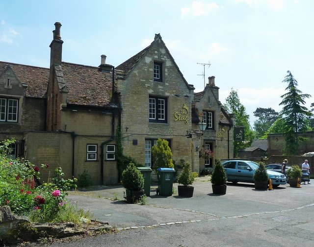
Mentmore - The Stag
This fine village pub, The Stag, is on the corner of the main road through Mentmore with The Green. When this photo was taken the pub was temporarily closed, hopefully it will reopen soon. This view is on a somewhat warmer and sunnier day than my last photo of it SP9019 : The Stag at Mentmore taken 7½ years earlier; though as can be seen it hasn't changed a lot in the intervening years.
Sadly, it seems that it has been closed since at least February (2014) despite getting 5* ratings on Trip Advisor Link for its food.
*Update* I'm pleased to report that The Stag has now re-opened - website here Link
Sadly, it seems that it has been closed since at least February (2014) despite getting 5* ratings on Trip Advisor Link
*Update* I'm pleased to report that The Stag has now re-opened - website here Link
 Map © Crown Copyright")
TIP: Click the map for more Large scale mapping
- Grid Square
- SP9019, 126 images (more nearby 🔍)
- Photographer
- Rob Farrow (more nearby)
- Date Taken
- Saturday, 17 May, 2014 (more nearby)
- Submitted
- Wednesday, 21 May, 2014
- Subject Location
-
OSGB36:
 SP 9071 1971 [10m precision]
WGS84: 51:52.1161N 0:41.0365W - Camera Location
-
OSGB36: SP 9070 1973
- View Direction
- South-southeast (about 157 degrees)