2014
NS5070 : Clydebank from the air
taken 10 years ago, near to Clydebank, West Dunbartonshire, Scotland
This is 1 of 9 images, with title Clydebank from the air in this square
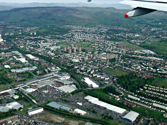
Clydebank from the air
The THOR building which stood in the brownfield site in the foreground has been demolished. It can be seen in this photo from 2007 NS5070 : Clydebank from the air.
 Map © Crown Copyright")
TIP: Click the map for more Large scale mapping
- Grid Square
- NS5070, 195 images (more nearby 🔍)
- Photographer
- Thomas Nugent (more nearby)
- Date Taken
- Monday, 19 May, 2014 (more nearby)
- Submitted
- Wednesday, 21 May, 2014
- Subject Location
-
OSGB36:
 NS 501 702 [100m precision]
WGS84: 55:54.1171N 4:23.9508W - View Direction
- Northwest (about 315 degrees)