2014
SH1731 : The Site of St Merin's Church
taken 10 years ago, near to Ty-Hen, Gwynedd, Wales
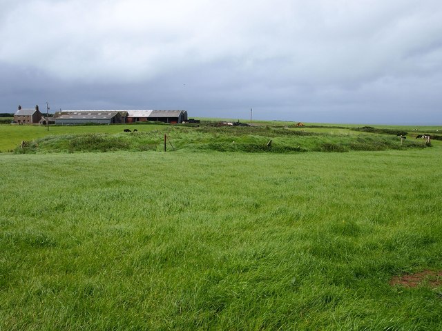
The Site of St Merin's Church
The earthworks in the field are all that is left of the church. Ty-mawr farm is in the distance.
 Map © Crown Copyright")
TIP: Click the map for more Large scale mapping
- Grid Square
- SH1731, 26 images (more nearby 🔍)
- Photographer
- Chris Andrews (more nearby)
- Date Taken
- Friday, 23 May, 2014 (more nearby)
- Submitted
- Friday, 23 May, 2014
- Subject Location
-
OSGB36:
 SH 1731 3149 [10m precision]
WGS84: 52:50.9900N 4:42.8680W - Camera Location
-
OSGB36: SH 1734 3152
- View Direction
- Southwest (about 225 degrees)