TQ1484 : Grand Union Canal and walk
taken 10 years ago, near to Greenford, Ealing, England
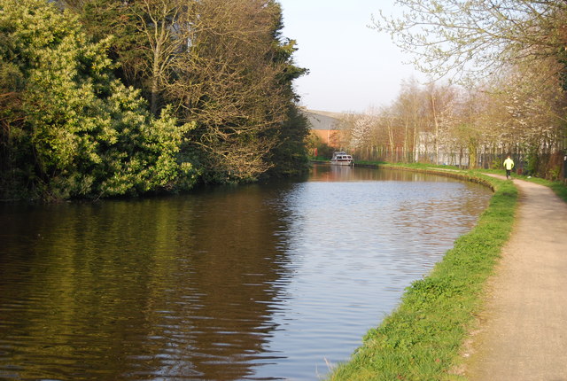
A 145 mile walk following the Grand Union Canal. This first national waterways walk was created as part of the celebrations of the 200th anniversary of the creation of the canal companies that later formed the Grand Union Canal. Being almost entirely towpath it provides much for those interested in canal history.
From the centre of London at Little Venice the canal heads to Slough and then through Hertfordshire and the Chilterns to Tring. Apart from the stretch through Milton Keynes the route is then largely rural passing the Canal Museum at Stoke Bruerne to Leamington Spa and Warwick. The final stretch is through the suburbs of Birmingham. Logo, see TQ1678 : Three walk logos, Gallows Bridge
The Grand Union is a 137 mile (220km), 166 lock, 2 tunnel canal running between Brentford in London and Birmingham. It is the longest canal in Britain, and has 11 main arms and junctions. It takes over a week to navigate.
The Leicester arm branches off at Norton Junction and runs 66 miles long through 59 locks (including 2 staircase locks at Foxton) and 2 tunnels to Leicester where it continues into the River Soar.
Read more at Wikipedia Link
 Map © Crown Copyright")
- Grid Square
- TQ1484, 197 images (more nearby 🔍)
- Photographer
- N Chadwick (more nearby)
- Date Taken
- Saturday, 29 March, 2014 (more nearby)
- Submitted
- Thursday, 29 May, 2014
- Subject Location
-
OSGB36:
 TQ 1469 8436 [10m precision]
WGS84: 51:32.7893N 0:20.8450W - Camera Location
-
OSGB36: TQ 1465 8433
- View Direction
- East-northeast (about 67 degrees)