TG1600 : Dilapidated building at RAF Hethel
taken 10 years ago, near to East Carleton, Norfolk, England
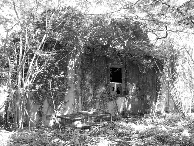
RAF Hethel was one of the first in Norfolk of the bomber stations built for the use by USAAF as a bomb squadron base. It was designated Station 114. Completed in 1942, the base was used by the 320th Bombardment Group and later by the 310th and 389th Bombardment Groups. The Station headquarters was based at the nearby Ketteringham Hall which from 1943 to 1945 also became the headquarters of the 2nd Air Division of the USAAF's 8th Air Force.
After the war, the airfield was handed over to RAF Fighter Command. It became a Personnel Transit Centre before being taken over by the RAF Technical Training Command until 1948, when the base was closed. The Air Ministry sold the airfield in 1964. Most of the buildings have since been demolished. The land is currently occupied by the Lotus Car Company, by an industrial estate and a chicken farm.
One of the aerodrome's defence sites has survived on the northern edge of the flying field.
See also: Link
 Map © Crown Copyright")
- Grid Square
- TG1600, 199 images (more nearby 🔍)
- Photographer
- Evelyn Simak (more nearby)
- Date Taken
- Sunday, 25 May, 2014 (more nearby)
- Submitted
- Saturday, 31 May, 2014
- Subject Location
-
OSGB36:
 TG 1609 0085 [10m precision]
WGS84: 52:33.7528N 1:11.2017E - Camera Location
-
OSGB36: TG 1608 0083
- View Direction
- North-northeast (about 22 degrees)