2014
NG9248 : An Ruadh Stac from the tourist path up Beinn Damh
taken 10 years ago, 5 km NW of Coulags, Highland, Scotland
This is 1 of 7 images, with title starting with An in this square
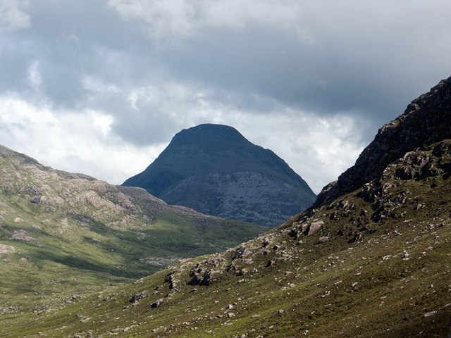
An Ruadh Stac from the tourist path up Beinn Damh
As the path ascends out of the valley a fine view is afforded of An Ruadh Stac dominating the view towards the head of Coire Roill. The cliffs of Creag na h-Iolaire form the nearer point of interest.
 Map © Crown Copyright")
TIP: Click the map for more Large scale mapping
- Grid Square
- NG9248, 26 images (more nearby 🔍)
- Photographer
- Julian Paren (more nearby)
- Date Taken
- Friday, 6 June, 2014 (more nearby)
- Submitted
- Monday, 9 June, 2014
- Subject Location
-
OSGB36:
 NG 921 480 [100m precision]
WGS84: 57:28.5008N 5:28.0843W - Camera Location
-
OSGB36: NG 879 524
- View Direction
- Southeast (about 135 degrees)