2014
TR2139 : Progress of the development of land adjoining The Mayfly, Defiant Close
taken 10 years ago, near to Hawkinge, Kent, England
This is 1 of 5 images, with title Progress of the development of land adjoining The Mayfly, Defiant Close in this square
Progress of the development of land adjoining The Mayfly, Defiant Close
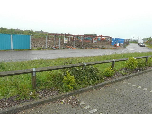
In less than two weeks since I photographed TR2139 : Development of land adjoining The Mayfly, Defiant Close, some of the girders of the new development have been erected. Planning permission has been approved, with conditions, by Folkestone and Hythe District Council under application number Y10/0739/SH for a mixed used development comprising the erection of 4, three storey blocks providing 8 ground floor commercial units (Classes A1, A2, A3, B1 uses) and 48, two bedroom apartments above, together with associated access, parking, landscaping and open space. The Mayfly refers to TR2139 : The Mayfly public house, Hawkinge.
 Map © Crown Copyright")
TIP: Click the map for more Large scale mapping
- Grid Square
- TR2139, 123 images (more nearby 🔍)
- Photographer
- John Baker (more nearby)
- Date Taken
- Tuesday, 27 May, 2014 (more nearby)
- Submitted
- Thursday, 12 June, 2014
- Subject Location
-
OSGB36:
 TR 2141 3943 [10m precision]
WGS84: 51:6.6825N 1:9.7081E - Camera Location
-
OSGB36: TR 2136 3945
- View Direction
- East-southeast (about 112 degrees)