2014
NS8217 : Spangobridge from Spango Bank
taken 10 years ago, near to Corsebank, Dumfries And Galloway, Scotland
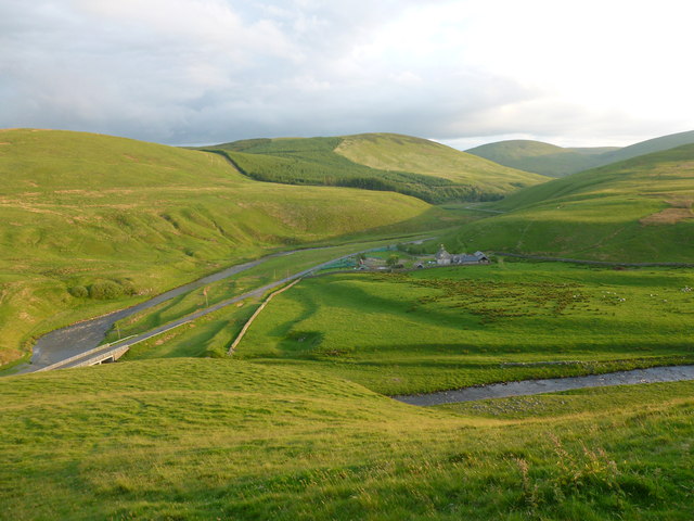
Spangobridge from Spango Bank
A view down the valley of the Crawick Water, where the B740 road runs.
 Map © Crown Copyright")
TIP: Click the map for more Large scale mapping
- Grid Square
- NS8217, 26 images (more nearby 🔍)
- Photographer
- Alan O'Dowd (more nearby)
- Date Taken
- Wednesday, 11 June, 2014 (more nearby)
- Submitted
- Thursday, 12 June, 2014
- Subject Location
-
OSGB36:
 NS 8217 1782 [10m precision]
WGS84: 55:26.4021N 3:51.8431W - Camera Location
-
OSGB36: NS 8237 1807
- View Direction
- Southwest (about 225 degrees)