2014
TG0715 : Long bend in Stone Road
taken 10 years ago, near to Primrose Green, Norfolk, England
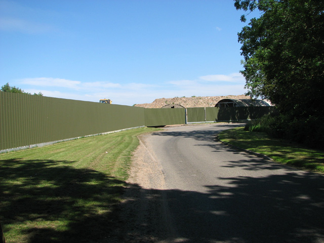
Long bend in Stone Road
Poultry houses are hidden behind the high fencing. Behind the fence, in the view direction, was the Technical site from the Hockering Forward Ammunition Depot. The roofs of what would appear to be two original Nissen huts can be seen behind the fence. The depot was located in Hockering Wood > Link
RAF Attlebridge (USAAF Station 120)
The Attlebridge aerodrome, named after the nearest railway station, was initially built for the use by No. 2 Group RAF (light bombers). It was completed in August 1942 and used by No. 88 Squadron RAF from August 1941 to September 1942. On 30 September 1942, Attlebridge was assigned to the United States Army Air Forces (USAAF) Eighth Air Force's 2nd Bomb Wing and given the USAAF designation of Station 120.
From March 1944, the airfield was used by the 466th Bombardment Group (Heavy) which flew its last mission in April 1945. After the war, the airfield was placed under care and maintenance before being closed in 1950. It was sold during 1959-62 and the runways have since been used for extensive poultry rearing operations.
See also Link
 Map © Crown Copyright")
TIP: Click the map for more Large scale mapping
- Grid Square
- TG0715, 15 images (more nearby 🔍)
- Photographer
- Evelyn Simak (more nearby)
- Date Taken
- Friday, 13 June, 2014 (more nearby)
- Submitted
- Saturday, 14 June, 2014
- Subject Location
-
OSGB36:
 TG 0797 1512 [10m precision]
WGS84: 52:41.6284N 1:4.5638E - Camera Location
-
OSGB36: TG 0790 1511
- View Direction
- EAST (about 90 degrees)