2014
SZ0891 : Bournemouth: United Reformed church from its corner steps
taken 10 years ago, near to Bournemouth, Bournemouth, Christchurch & Poole, England
This is 1 of 689 images, with title starting with Bournemouth in this square
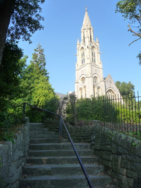
Bournemouth: United Reformed church from its corner steps
The recent clearance of large trees from the Bourne Avenue edge of the churchyard means that, for the first time in many years, SZ0891 : Bournemouth: Richmond Hill St. Andrews United Reformed Church is visible from the foot of the steps. (The entrance to the steps can be seen in the extreme bottom-right corner of the linked picture.)
 Map © Crown Copyright")
TIP: Click the map for more Large scale mapping
- Grid Square
- SZ0891, 1884 images (more nearby 🔍)
- Photographer
- Chris Downer (more nearby)
- Date Taken
- Monday, 23 June, 2014 (more nearby)
- Submitted
- Monday, 23 June, 2014
- Subject Location
-
OSGB36:
 SZ 0851 9135 [10m precision]
WGS84: 50:43.3028N 1:52.8486W - Camera Location
-
OSGB36: SZ 0846 9134
- View Direction
- East-northeast (about 67 degrees)