2007
SN1134 : Gorse topiary and distant peaks
taken 17 years ago, near to Brynberian, Pembrokeshire/Sir Benfro, Wales
Gorse topiary and distant peaks
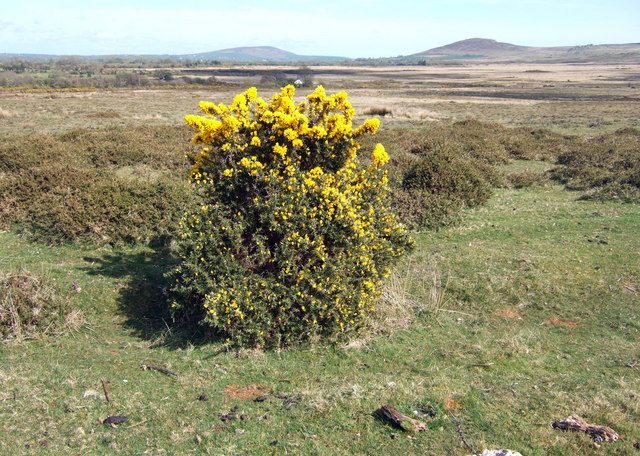
The gorse bushes on this open moorland southeast of Brynberian have taken on strange forms: close-cropped around the base, the flowers bloom with great abundance on the higher shoots out of reach of the sheep.
The mountains on the skyline are Frenni Fawr away to the east and Foel Drygarn, southeast, both part of the Preseli range.
Above the gorse bush can be seen the isolated farm Glanyrafon Uchaf.
The mountains on the skyline are Frenni Fawr away to the east and Foel Drygarn, southeast, both part of the Preseli range.
Above the gorse bush can be seen the isolated farm Glanyrafon Uchaf.
 Map © Crown Copyright")
TIP: Click the map for more Large scale mapping
- Grid Square
- SN1134, 6 images (more nearby 🔍)
- Photographer
- Natasha Ceridwen de Chroustchoff (more nearby)
- Date Taken
- Tuesday, 17 April, 2007 (more nearby)
- Submitted
- Wednesday, 18 April, 2007
- Subject Location
-
OSGB36:
 SN 112 348 [100m precision]
WGS84: 51:58.7826N 4:44.9514W - Camera Location
-
OSGB36: SN 111 348
- View Direction
- EAST (about 90 degrees)