2014
NS3382 : Path to Craigendoran
taken 10 years ago, near to Daligan, Argyll And Bute, Scotland
This is 1 of 7 images, with title Path to Craigendoran in this square
Path to Craigendoran
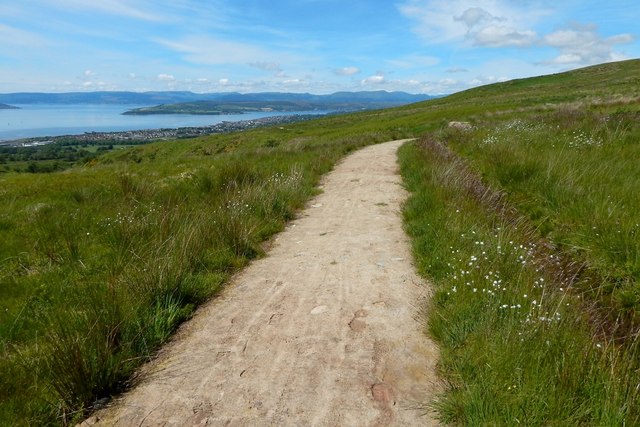
The path, newly made, is shown in NS3482 : Path to Craigendoran; the present picture is from further along it, at the point where the town of Helensburgh begins to come more clearly into view on the near shore of the Clyde. The Rosneath Peninsula is prominent in the background, where it can be seen, left of centre, in the Firth.
There is a drainage channel just to the right of the path (compare NS3382 : Path to Goukhill Muir, a view in the opposite direction). The path veers right here because the deep glen of the Red Burn, which the path flanks, does the same, as is shown on the map and in NS3382 : The glen of the Red Burn.
There is a drainage channel just to the right of the path (compare NS3382 : Path to Goukhill Muir, a view in the opposite direction). The path veers right here because the deep glen of the Red Burn, which the path flanks, does the same, as is shown on the map and in NS3382 : The glen of the Red Burn.
 Map © Crown Copyright")
TIP: Click the map for more Large scale mapping
- Grid Square
- NS3382, 54 images (more nearby 🔍)
- Photographer
- Lairich Rig (more nearby)
- Date Taken
- Friday, 6 June, 2014 (more nearby)
- Submitted
- Saturday, 28 June, 2014
- Subject Location
-
OSGB36:
 NS 3374 8219 [10m precision]
WGS84: 56:0.2244N 4:40.0750W - Camera Location
-
OSGB36: NS 3378 8219
- View Direction
- WEST (about 270 degrees)