2014
SX0081 : Coastal Path
taken 10 years ago, near to Port Gaverne, Cornwall, England
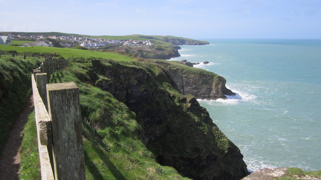
Coastal Path
View of Port Isaac from the South West Coastal Path, as seen from Tresungers Point.
 Map © Crown Copyright")
TIP: Click the map for more Large scale mapping
- Grid Square
- SX0081, 36 images (more nearby 🔍)
- Photographer
- Chris McAuley (more nearby)
- Date Taken
- Tuesday, 8 April, 2014 (more nearby)
- Submitted
- Monday, 30 June, 2014
- Subject Location
-
OSGB36:
 SX 007 811 [100m precision]
WGS84: 50:35.7312N 4:49.0324W - Camera Location
-
OSGB36: SX 007 811
- View Direction
- West-southwest (about 247 degrees)