2014
TM4078 : The Operations block
taken 10 years ago, near to Broadway, Suffolk, England
This is 1 of 2 images, with title The Operations block in this square
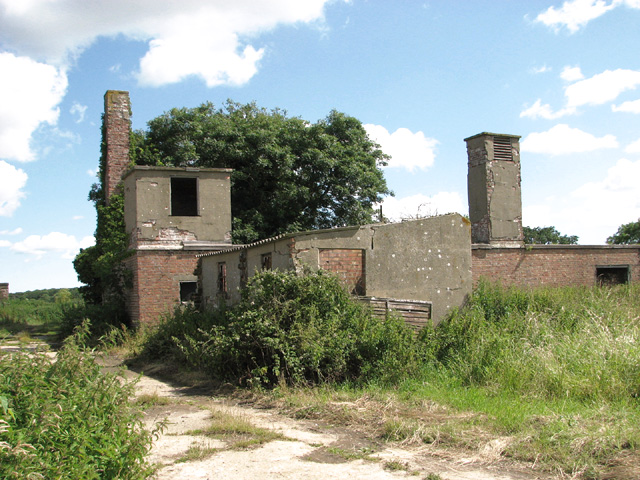
The Operations block
It stands on the former Admin site of RAF Halesworth.
RAF Halesworth (USAAF Station 365)
The airfield is occasionally also referred to as Holton airfield. Built in 1942/43 as a Class A bomber base, the main runway was 1,8 kilometres (6000 feet) long and the dispersed camps accommodated about 3000 personnel. The first unit to be based here was the 56th Fighter Group (FG) which arrived from RAF Horsham St Faith (now Norwich International Airport) in July 1943. The 489th Bombardment Group (Heavy) took over later, and in January 1945 the 5th Emergency Rescue Squadron moved in.
The airfield was closed for flying in February 1946 and in 1963 it was purchased by Bernard Matthews Farms Ltd. More recently the runways were broken up for aggregate and a large solar farm now occupies much of the former airfield. See also: Link
 Map © Crown Copyright")
TIP: Click the map for more Large scale mapping
- Grid Square
- TM4078, 119 images (more nearby 🔍)
- Photographer
- Evelyn Simak (more nearby)
- Date Taken
- Monday, 30 June, 2014 (more nearby)
- Submitted
- Tuesday, 1 July, 2014
- Subject Location
-
OSGB36:
 TM 4049 7875 [10m precision]
WGS84: 52:21.2412N 1:31.8038E - Camera Location
-
OSGB36: TM 4048 7874
- View Direction
- Northeast (about 45 degrees)