2014
SS9746 : Environment Agency benchmark
taken 10 years ago, near to Minehead, Somerset, England
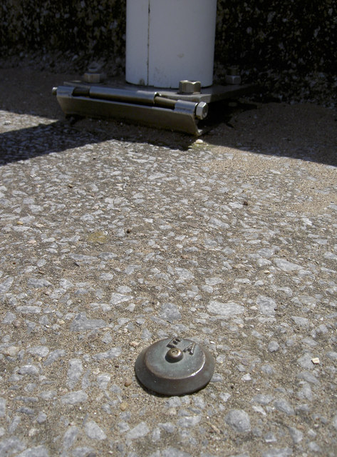
Environment Agency benchmark
One of a number of such marks in the circular parts of The Strand, these are placed near the waters.
 Map © Crown Copyright")
TIP: Click the map for more Large scale mapping
- Grid Square
- SS9746, 1055 images (more nearby 🔍)
- Photographer
- Neil Owen (more nearby)
- Date Taken
- Thursday, 19 June, 2014 (more nearby)
- Submitted
- Thursday, 10 July, 2014
- Subject Location
-
OSGB36:
 SS 9753 4639 [10m precision]
WGS84: 51:12.4497N 3:28.0947W - Camera Location
-
OSGB36: SS 9753 4640
- View Direction
- SOUTH (about 180 degrees)