2002
TQ3732 : West Hoathley: site of former station and Sharpthorne Tunnel on Bluebell Railway, 2002
taken 22 years ago, near to Sharpthorne, West Sussex, England
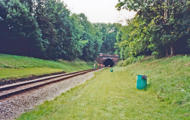
West Hoathley: site of former station and Sharpthorne Tunnel on Bluebell Railway, 2002
View southward, towards Horsted Keynes and Lewes: ex-LB&SCR (London) - Oxted - East Grinstead - Lewes - (Brighton) line. The station and line were closed finally on 17/3/58, but the line was acquired by the heritage Bluebell Railway and reopened Sheffield Park - Horsted Keynes 31/7/60, then, after demolishing the remains of West Hoathley station, on through here to Kingscote in 1994 - and eventually to East Grinstead in March 2013. (Cf. TQ3631 : West Hoathly Tunnel on the Bluebell Railway).
 Map © Crown Copyright")
TIP: Click the map for more Large scale mapping
- Grid Square
- TQ3732, 101 images (more nearby 🔍)
- Photographer
- Ben Brooksbank (more nearby)
- Date Taken
- Sunday, 1 September, 2002 (more nearby)
- Submitted
- Friday, 11 July, 2014
- Subject Location
-
OSGB36:
 TQ 3711 3267 [10m precision]
WGS84: 51:4.6189N 0:2.6480W - Camera Location
-
OSGB36: TQ 3713 3289
- View Direction
- SOUTH (about 180 degrees)