2014
SK5744 : Day Brook Recreation Ground, Nottingham NG5
taken 10 years ago, 3 km from Arnold, Nottinghamshire, England
This is 1 of 8 images, with title Day Brook Recreation Ground, Nottingham NG5 in this square
Day Brook Recreation Ground, Nottingham NG5
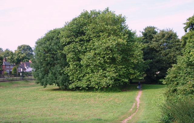
With Valley Road (the A6514) on the left, this picture shows the footpath descending towards the bowling greens and an intersecting footpath that links Valley Road and Mossdale Road. At this point the brook is running along the right-hand side of the photographer (off-screen).
 Map © Crown Copyright")
TIP: Click the map for more Large scale mapping
- Grid Square
- SK5744, 112 images (more nearby 🔍)
- Photographer
- David Hallam-Jones (more nearby)
- Date Taken
- Saturday, 12 July, 2014 (more nearby)
- Submitted
- Saturday, 12 July, 2014
- Subject Location
-
OSGB36:
 SK 5748 4416 [10m precision]
WGS84: 52:59.5018N 1:8.7078W - Camera Location
-
OSGB36: SK 5749 4416
- View Direction
- Southwest (about 225 degrees)