2014
NN1089 : Burn course of Allt na Briobaig
taken 10 years ago, 4 km W of Ardechive, Highland, Scotland
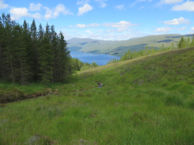
Burn course of Allt na Briobaig
Looking down towards Loch Arkaig
 Map © Crown Copyright")
TIP: Click the map for more Large scale mapping
- Grid Square
- NN1089, 3 images (more nearby 🔍)
- Photographer
- John Ferguson (more nearby)
- Date Taken
- Friday, 11 July, 2014 (more nearby)
- Submitted
- Sunday, 13 July, 2014
- Subject Location
-
OSGB36:
 NN 1058 8970 [10m precision]
WGS84: 56:57.5775N 5:7.0151W - Camera Location
-
OSGB36: NN 1065 8964
- View Direction
- Northwest (about 315 degrees)