1976
SU3268 : Hungerford Marsh Lock No 73, Kennet and Avon Canal
taken 48 years ago, near to Hungerford, West Berkshire, England
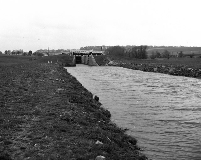
Hungerford Marsh Lock No 73, Kennet and Avon Canal
West of Hungerford, the Kennet and Avon begins to rise more steeply, with locks coming at frequent intervals towards the summit at Great Bedwyn.
 Map © Crown Copyright")
TIP: Click the map for more Large scale mapping
- Grid Square
- SU3268, 100 images (more nearby 🔍)
- Photographer
- Dr Neil Clifton (more nearby)
- Date Taken
- Saturday, 27 March, 1976 (more nearby)
- Submitted
- Friday, 20 April, 2007
- Subject Location
-
OSGB36:
 SU 326 685 [100m precision]
WGS84: 51:24.8911N 1:31.8968W - Camera Location
-
OSGB36: SU 329 685
- View Direction
- WEST (about 270 degrees)