2014
NT2745 : From Cardon Law summit
taken 10 years ago, 4 km ESE of Eddleston, Scottish Borders, Scotland
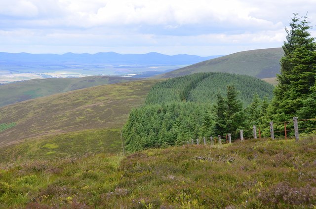
From Cardon Law summit
The Pentland Hills skyline from the summit of Cardon Law with the bulky slope of Brown Dod and Dundreich to the right.
 Map © Crown Copyright")
TIP: Click the map for more Large scale mapping
- Grid Square
- NT2745, 23 images (more nearby 🔍)
- Photographer
- Jim Barton (more nearby)
- Date Taken
- Tuesday, 15 July, 2014 (more nearby)
- Submitted
- Wednesday, 16 July, 2014
- Subject Location
-
OSGB36:
 NT 2775 4576 [10m precision]
WGS84: 55:41.9933N 3:9.0670W - Camera Location
-
OSGB36: NT 2777 4573
- View Direction
- North-northwest (about 337 degrees)