2014
SD8380 : Cam Rakes
taken 10 years ago, 3 km from Oughtershaw, North Yorkshire, England
This is 1 of 3 images, with title Cam Rakes in this square
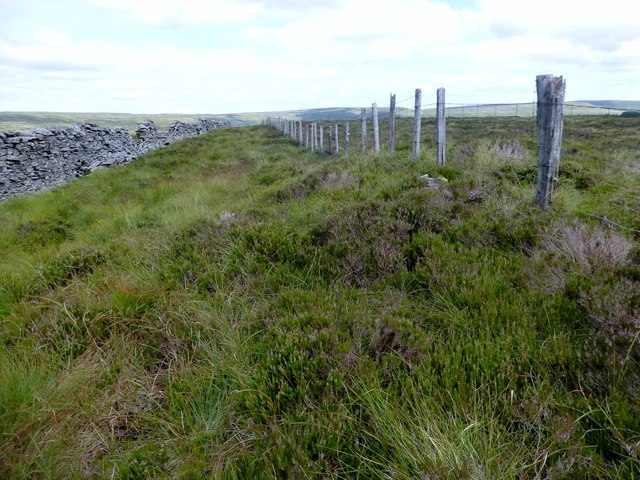
Cam Rakes
Walked up via the footpath from Oughtershaw then followed wall and fence round the north of the forest to hit the summit and then the trig. The summit is 100m NE of trig point and is marked by a few stones next to the old fence.
Name: Cam Rakes [Oughtershaw Common] [Cocklee Fell]
Hill number: 3627
Height: 503m / 1650ft
Parent (Ma/M): 2799 Birks Fell
Area: 35B: The Central Pennines
Class: Hu,5
Grid ref: SD 83902 80953
Summit feature: a few stones by fence
Drop: 113m
Col: 390m SD822785
Name: Cam Rakes [Oughtershaw Common] [Cocklee Fell]
Hill number: 3627
Height: 503m / 1650ft
Parent (Ma/M): 2799 Birks Fell
Area: 35B: The Central Pennines
Class: Hu,5
Grid ref: SD 83902 80953
Summit feature: a few stones by fence
Drop: 113m
Col: 390m SD822785
 Map © Crown Copyright")
TIP: Click the map for more Large scale mapping
- Grid Square
- SD8380, 15 images (more nearby 🔍)
- Photographer
- Rude Health (more nearby)
- Date Taken
- Monday, 21 July, 2014 (more nearby)
- Submitted
- Tuesday, 22 July, 2014
- Subject Location
-
OSGB36:
 SD 8395 8096 [10m precision]
WGS84: 54:13.4462N 2:14.8601W - Camera Location
-
OSGB36: SD 8394 8095
- View Direction
- Northeast (about 45 degrees)