2014
TA0323 : New Holland to the Humber Bridge: aerial view up the South Bank of the Humber, 2014
taken 10 years ago, near to Humber Bridge, East Riding of Yorkshire, England
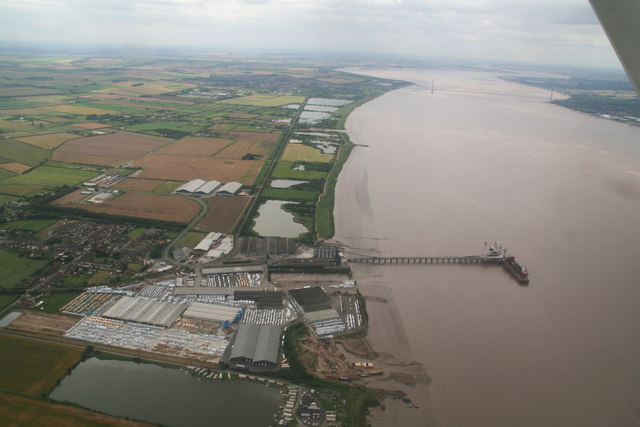
New Holland to the Humber Bridge: aerial view up the South Bank of the Humber, 2014
New Holland Pier in the foreground, and Barton-upon-Humber left of the bridge.
 Map © Crown Copyright")
TIP: Click the map for more Large scale mapping
- Grid Square
- TA0323, 220 images (more nearby 🔍)
- Photographer
- Chris (more nearby)
- Date Taken
- Tuesday, 15 July, 2014 (more nearby)
- Submitted
- Tuesday, 22 July, 2014
- Subject Location
-
OSGB36:
 TA 037 232 [100m precision]
WGS84: 53:41.7078N 0:25.8273W - Camera Location
-
OSGB36: TA 089 247
- View Direction
- West-southwest (about 247 degrees)