2014
TQ2619 : Driving Ground, Hickstead Show Jumping Course
taken 10 years ago, near to Hickstead, West Sussex, England
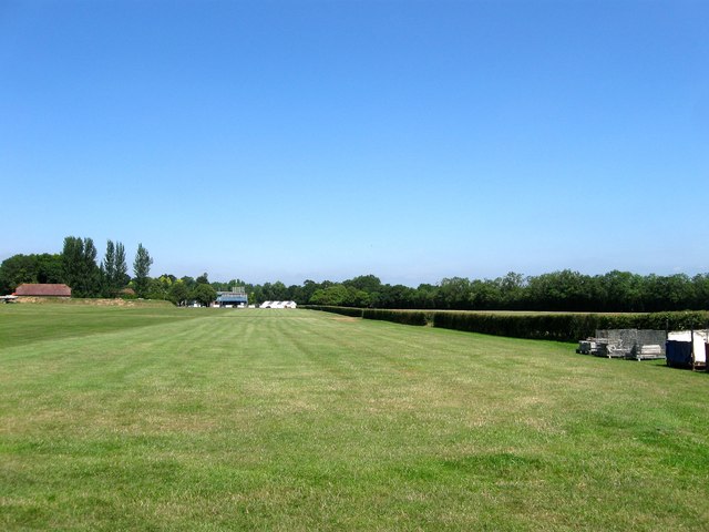
Driving Ground, Hickstead Show Jumping Course
Originally a couple of fields called Apps Cross and Barn Field that since 1960 have been part of the grounds of Hickstead arena. This strip is marked as an airstrip on OS maps since the 1970s though Hickstead's own site map has this as a driving ground. Beyond the hedge to the right is TQ2619 : Public Car Parking Area, Hickstead Show Jumping Course whilst in the distance to the left is Berrylands Barn that dates back to the 17th century.
 Map © Crown Copyright")
TIP: Click the map for more Large scale mapping
- Grid Square
- TQ2619, 64 images (more nearby 🔍)
- Photographer
- Simon Carey (more nearby)
- Date Taken
- Tuesday, 22 July, 2014 (more nearby)
- Submitted
- Thursday, 24 July, 2014
- Subject Location
-
OSGB36:
 TQ 2679 1941 [10m precision]
WGS84: 50:57.6105N 0:11.7601W - Camera Location
-
OSGB36: TQ 2675 1921
- View Direction
- North-northeast (about 22 degrees)