2014
SU3802 : Beaulieu Abbey Ruins
taken 10 years ago, near to Beaulieu, Hampshire, England
This is 1 of 6 images, with title Beaulieu Abbey Ruins in this square
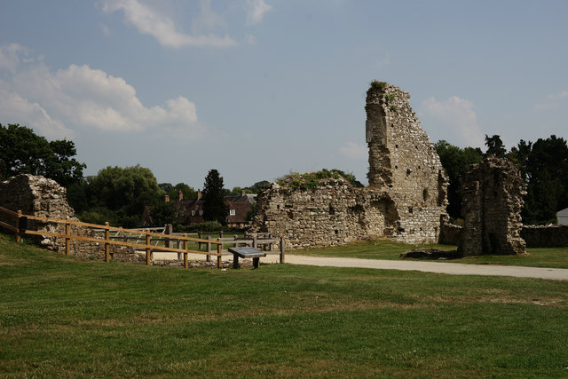
Beaulieu Abbey Ruins
On the edge of the abbey site, the ruins of the fulling mill.
 Map © Crown Copyright")
TIP: Click the map for more Large scale mapping
- Grid Square
- SU3802, 661 images (more nearby 🔍)
- Photographer
- Peter Trimming (more nearby)
- Date Taken
- Wednesday, 23 July, 2014 (more nearby)
- Submitted
- Tuesday, 29 July, 2014
- Subject Location
-
OSGB36:
 SU 3877 0274 [10m precision]
WGS84: 50:49.3746N 1:27.0574W - Camera Location
-
OSGB36: SU 38753 02770
- View Direction
- Southeast (about 135 degrees)