2014
TM0198 : Industrial estate at Stalland Common
taken 10 years ago, near to Stalland Common, Norfolk, England
This is 1 of 5 images, with title Industrial estate at Stalland Common in this square
Industrial estate at Stalland Common
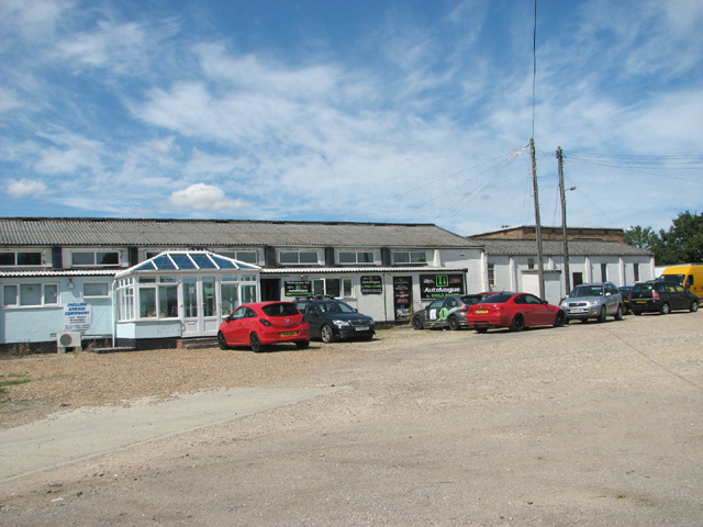
The small industrial estate is located on the former Communal site of RAF Deopham Green. The building depicted here used to be the Gymnasium, which had an extension used as the site's chapel.
RAF Deopham Green (USAAF Station 142)
RAF Deopham Green is a former World War II aerodrome, built in 1942/43 and located near the hamlet of Deopham Green. Opened in 1944, the airfield was used by the United States Army Air Force (USAAF) Eighth Air Force 452nd Bombardment Group (Heavy). After the war the field was handed back to RAF Maintenance Command and public roads that had been closed during construction were re-opened. The airfield was closed in 1948 with most of the buildings torn down and the land returned to agricultural use. Many of the runways and taxiways of the old airfield remain. See also: Link
 Map © Crown Copyright")
TIP: Click the map for more Large scale mapping
- Grid Square
- TM0198, 30 images (more nearby 🔍)
- Photographer
- Evelyn Simak (more nearby)
- Date Taken
- Tuesday, 29 July, 2014 (more nearby)
- Submitted
- Wednesday, 30 July, 2014
- Subject Location
-
OSGB36:
 TM 0185 9850 [10m precision]
WGS84: 52:32.8148N 0:58.5296E - Camera Location
-
OSGB36: TM 0187 9849
- View Direction
- Northwest (about 315 degrees)