2014
SU1482 : West along Stonehenge Road, Wichelstowe, Swindon
taken 10 years ago, near to Wroughton, Swindon, England
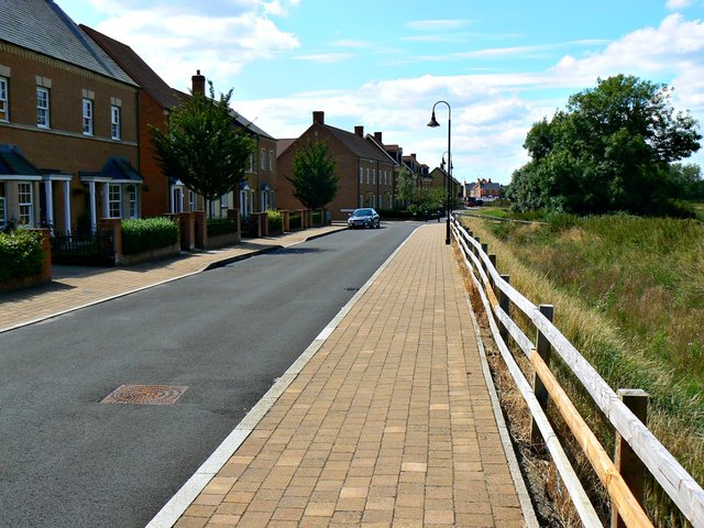
West along Stonehenge Road, Wichelstowe, Swindon
The houses here are part of the Wichelstowe development on land once called colloquially Swindon's front garden. The view was a little different in 2007 when I last photographed it Link from a viewpoint that is now inside a school playground.
 Map © Crown Copyright")
TIP: Click the map for more Large scale mapping
- Grid Square
- SU1482, 106 images (more nearby 🔍)
- Photographer
- Brian Robert Marshall (more nearby)
- Date Taken
- Tuesday, 29 July, 2014 (more nearby)
- Submitted
- Wednesday, 30 July, 2014
- Subject Location
-
OSGB36:
 SU 144 827 [100m precision]
WGS84: 51:32.6116N 1:47.5504W - Camera Location
-
OSGB36: SU 145 827
- View Direction
- West-southwest (about 247 degrees)