TQ4707 : Firle War Memorial
taken 10 years ago, near to Firle, East Sussex, England
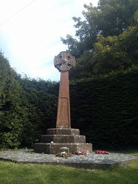
War memorials were mainly constructed after WWI to commemorate the troops who gave their lives in the war. Many were then updated after WWII. Some war memorials date back to the Boer War. Almost every town and village in Britain has a War Memorial. They take many forms, the commonest being an obelisk, a cross or statue of a soldier. Some commemorate the inhabitants of a place, some are for schools and others are for companies or Military groupings.
Many memorials are grade II listed, 61 are II* listed, Link*_listed_war_memorials_in_England
& 12 are Grade I listed. Link
A search for memorials can be carried out at Link
Firle is a small village south of the A27. It sits at the foot of the South Downs. The village has a 13th century church, public house, a blacksmiths and one of the oldest cricket clubs in the world. It also has its own Bonfire Society.
Firle Place is to the east of the village, this dates back to Tudor times.
 Map © Crown Copyright")
- Grid Square
- TQ4707, 276 images (more nearby 🔍)
- Photographer
- PAUL FARMER (more nearby)
- Date Taken
- Friday, 1 August, 2014 (more nearby)
- Submitted
- Sunday, 3 August, 2014
- Subject Location
-
OSGB36:
 TQ 4702 0720 [10m precision]
WGS84: 50:50.7389N 0:5.2171E - Camera Location
-
OSGB36: TQ 4700 0722
- View Direction
- Southeast (about 135 degrees)