2013
SX8565 : The line of Wrigwell Lane running northwest from a footpath crossing
taken 11 years ago, near to Ipplepen, Devon, England
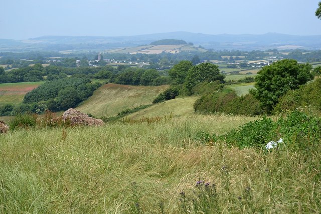
The line of Wrigwell Lane running northwest from a footpath crossing
The line of hedges and trees from right to centre marks the line, in places a "tunnel of green gloom". The footpath crossing and viewpoint are seen in SX8565 : Orange Way in Devon and Torbay (77). In the distance is Denbury Camp or Denbury Down, a landmark hill crowned with trees SX8168. The village with the church tower, left, is perhaps Torbryan SX8166 with the outskirts of Ipplepen on the right SX8366.
 Map © Crown Copyright")
TIP: Click the map for more Large scale mapping
- Grid Square
- SX8565, 40 images (more nearby 🔍)
- Photographer
- Robin Stott (more nearby)
- Date Taken
- Sunday, 7 July, 2013 (more nearby)
- Submitted
- Thursday, 7 August, 2014
- Subject Location
-
OSGB36:
 SX 8511 6519 [10m precision]
WGS84: 50:28.5142N 3:37.2284W - Camera Location
-
OSGB36: SX 8523 6507
- View Direction
- Northwest (about 315 degrees)