2014
TR3141 : Erection of a house, Priory Hill
taken 10 years ago, near to Dover, Kent, England
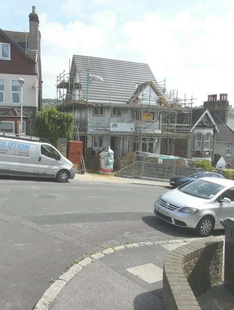
Erection of a house, Priory Hill
Planning permission has been granted by Dover District Council under application number DOV/13/00926 for the erection of a detached dwelling on land adjacent (to) 28 Priory Hill. After the building work had been completed, the address of the house was known as TR3141 : 30, Priory Hill.
 Map © Crown Copyright")
TIP: Click the map for more Large scale mapping
- Grid Square
- TR3141, 1287 images (more nearby 🔍)
- Photographer
- John Baker (more nearby)
- Date Taken
- Friday, 1 August, 2014 (more nearby)
- Submitted
- Sunday, 10 August, 2014
- Subject Location
-
OSGB36:
 TR 3143 4177 [10m precision]
WGS84: 51:7.7055N 1:18.3722E - Camera Location
-
OSGB36: TR 3141 4176
- View Direction
- Northeast (about 45 degrees)