2010
SY3192 : Trackbed Cannington Viaduct
taken 14 years ago, near to Pinhay, Devon, England
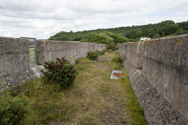
Trackbed Cannington Viaduct
Few photographers seem to have bush-wacked their way to the top of the disused viaduct so I took the liberty to investigate myself.
 Map © Crown Copyright")
TIP: Click the map for more Large scale mapping
- Grid Square
- SY3192, 31 images (more nearby 🔍)
- Photographer
- Noel Jenkins (more nearby)
- Date Taken
- Saturday, 17 July, 2010 (more nearby)
- Submitted
- Thursday, 14 August, 2014
- Subject Location
-
OSGB36:
 SY 31710 92415 [1m precision]
WGS84: 50:43.6394N 2:58.1339W - Camera Location
-
OSGB36: SY 31710 92415
- View Direction
- WEST (about 270 degrees)