2014
ST3530 : To dredge or not to dredge...
taken 10 years ago, near to Burrowbridge, Somerset, England
To dredge or not to dredge...
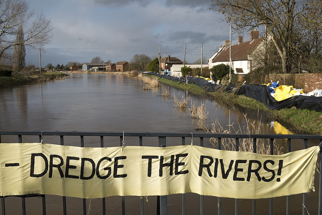
Local people make their feelings known to the authorities during the acute flood event of winter 2014. Since the river Parrett is higher than the surrounding levels at this point, it's fairly obvious that other strategies are required as well.
 Map © Crown Copyright")
TIP: Click the map for more Large scale mapping
- Grid Square
- ST3530, 136 images (more nearby 🔍)
- Photographer
- Noel Jenkins (more nearby)
- Date Taken
- Sunday, 2 February, 2014 (more nearby)
- Submitted
- Friday, 15 August, 2014
- Subject Location
-
OSGB36:
 ST 35744 30435 [1m precision]
WGS84: 51:4.1779N 2:55.1073W - Camera Location
-
OSGB36: ST 35744 30435
- View Direction
- Northwest (about 315 degrees)