2014
J2743 : View south-westwards along the Windy Gap Pad
taken 10 years ago, 5 km S of Finnis, Co Down, Northern Ireland
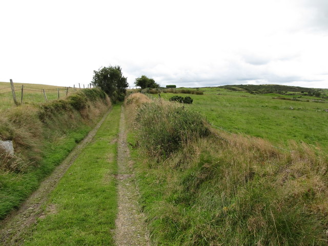
View south-westwards along the Windy Gap Pad
"Pad" is the Ulster-Scots form of the English word "path". The circular hedge of the Windy Gap Marian shrine can be seen on the skyline.
Link (Archive Link )
Link (Archive Link )
Link
Link
Loading map... (JavaScript required)
- Grid Square
- J2743, 59 images (more nearby 🔍)
- Photographer
- Eric Jones (more nearby)
- Date Taken
- Friday, 15 August, 2014 (more nearby)
- Submitted
- Sunday, 17 August, 2014
- Subject Location
-
Irish:
 J 276 432 [100m precision]
WGS84: 54:19.3117N 6:2.3540W - Camera Location
-
Irish: J 277 432
- View Direction
- Southwest (about 225 degrees)