2014
NO5106 : Kellie Law
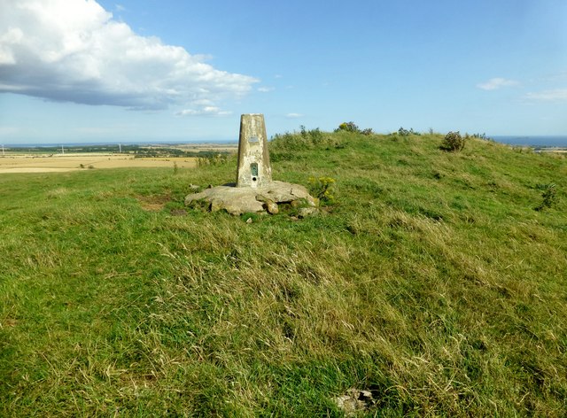
taken 10 years ago, near to Arncroach, Fife, Scotland
This is 1 of 2 images, with title Kellie Law in this square
Kellie Law
Parked on verge and used track near Carnbee Farm to gain access to the summit on another warm day.
Name: Kellie Law
Hill number: 12984
Height: 182m / 597ft
Parent (Ma/M): 1672 Largo Law
Area: 26A: Central Scotland from Dumbarton to Montrose
Class: 1
Grid ref: NO 51759 06448
Summit feature: mound near trig point
Drop: 44m
Col: 138m
Name: Kellie Law
Hill number: 12984
Height: 182m / 597ft
Parent (Ma/M): 1672 Largo Law
Area: 26A: Central Scotland from Dumbarton to Montrose
Class: 1
Grid ref: NO 51759 06448
Summit feature: mound near trig point
Drop: 44m
Col: 138m
 Map © Crown Copyright")
TIP: Click the map for more Large scale mapping
- Grid Square
- NO5106, 40 images (more nearby 🔍)
- Photographer
- Rude Health (more nearby)
- Date Taken
- Thursday, 7 August, 2014 (more nearby)
- Submitted
- Monday, 18 August, 2014
- Subject Location
-
OSGB36:
 NO 5175 0645 [10m precision]
WGS84: 56:14.8864N 2:46.8125W - Camera Location
-
OSGB36: NO 5173 0645
- View Direction
- EAST (about 90 degrees)