2014
NJ8500 : Boundary stone at Maryculter Bridge
taken 10 years ago, near to Kirkton of Maryculter, Aberdeenshire, Scotland
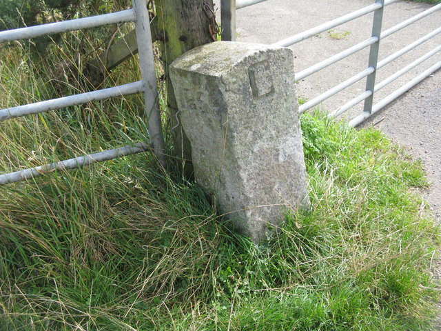
Boundary stone at Maryculter Bridge
Marked '1859' and 'C' it possibly marks the boundary between Aberdeen and Kincardine counties.
 Map © Crown Copyright")
TIP: Click the map for more Large scale mapping
- Grid Square
- NJ8500, 45 images (more nearby 🔍)
- Photographer
- M J Richardson (more nearby)
- Date Taken
- Monday, 18 August, 2014 (more nearby)
- Submitted
- Tuesday, 19 August, 2014
- Subject Location
-
OSGB36:
 NJ 8585 0044 [10m precision]
WGS84: 57:5.6835N 2:14.1090W - Camera Location
-
OSGB36: NJ 8584 0045
- View Direction
- Southeast (about 135 degrees)