2014
SU7567 : 'Red Roof', Church Lane
taken 10 years ago, near to Arborfield, Wokingham, England
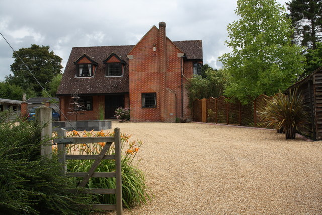
'Red Roof', Church Lane
There is an OS benchmark SU7567 : Benchmark on 'Red Roof', Church Lane on the face of the forward jut of the house at its left hand corner
 Map © Crown Copyright")
TIP: Click the map for more Large scale mapping
- Grid Square
- SU7567, 97 images (more nearby 🔍)
- Photographer
- Roger Templeman (more nearby)
- Date Taken
- Tuesday, 8 July, 2014 (more nearby)
- Submitted
- Tuesday, 19 August, 2014
- Subject Location
-
OSGB36:
 SU 7566 6767 [10m precision]
WGS84: 51:24.1814N 0:54.8227W - Camera Location
-
OSGB36: SU 7563 6768
- View Direction
- East-southeast (about 112 degrees)