2014
NZ1629 : South entrance to Witton Castle
taken 10 years ago, near to Etherley, County Durham, England
This is 1 of 4 images, with title starting with South in this square
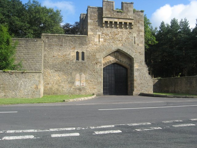
South entrance to Witton Castle
Originally built in the 15th. century, Witton is now a country and leisure park. For more information on this gate, see NZ1629 : South Lodge : Witton Castle.
 Map © Crown Copyright")
TIP: Click the map for more Large scale mapping
- Grid Square
- NZ1629, 14 images (more nearby 🔍)
- Photographer
- James Denham (more nearby)
- Date Taken
- Wednesday, 30 July, 2014 (more nearby)
- Submitted
- Wednesday, 20 August, 2014
- Subject Location
-
OSGB36:
 NZ 1607 2940 [10m precision]
WGS84: 54:39.5662N 1:45.1448W - Camera Location
-
OSGB36: NZ 1607 2937
- View Direction
- NORTH (about 0 degrees)