2014
NY3326 : Doddick Fell
taken 10 years ago, near to Scales, Cumbria, England
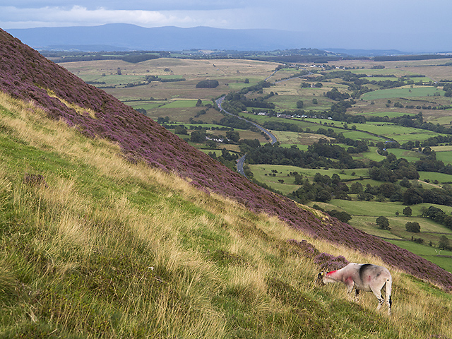
Doddick Fell
Steep ground on Doddick fell, viewed on a descent from Blencathra. The A66 trunk road can be seen in the middle distance, and Cross Fell in the Pennines is visible on the skyline.
 Map © Crown Copyright")
TIP: Click the map for more Large scale mapping
- Grid Square
- NY3326, 35 images (more nearby 🔍)
- Photographer
- William Starkey (more nearby)
- Date Taken
- Monday, 18 August, 2014 (more nearby)
- Submitted
- Thursday, 21 August, 2014
- Subject Location
-
OSGB36:
 NY 3328 2695 [10m precision]
WGS84: 54:37.9947N 3:2.1067W - Camera Location
-
OSGB36: NY 3321 2695
- View Direction
- EAST (about 90 degrees)