2014
SD6854 : Bridleway descending off Dunsop Fell
taken 10 years ago, 3 km from Slaidburn, Lancashire, England
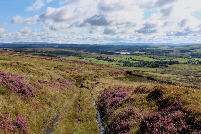
Bridleway descending off Dunsop Fell
Spectacular views are on offer as this moorland track descends towards the junction of Hornby Road and Wood House Lane - on the flanks of Dunsop Fell
 Map © Crown Copyright")
TIP: Click the map for more Large scale mapping
- Grid Square
- SD6854, 20 images (more nearby 🔍)
- Photographer
- Chris Heaton (more nearby)
- Date Taken
- Friday, 22 August, 2014 (more nearby)
- Submitted
- Saturday, 23 August, 2014
- Subject Location
-
OSGB36:
 SD 6888 5490 [10m precision]
WGS84: 53:59.3521N 2:28.5666W - Camera Location
-
OSGB36: SD 6879 5487
- View Direction
- East-northeast (about 67 degrees)