2014
SN7453 : Cwm Doethie Fawr, Ceredigion
taken 10 years ago, near to Doethie Fawr [water Feature], Ceredigion, Great Britain
This is 1 of 2 images, with title Cwm Doethie Fawr, Ceredigion in this square
Cwm Doethie Fawr, Ceredigion
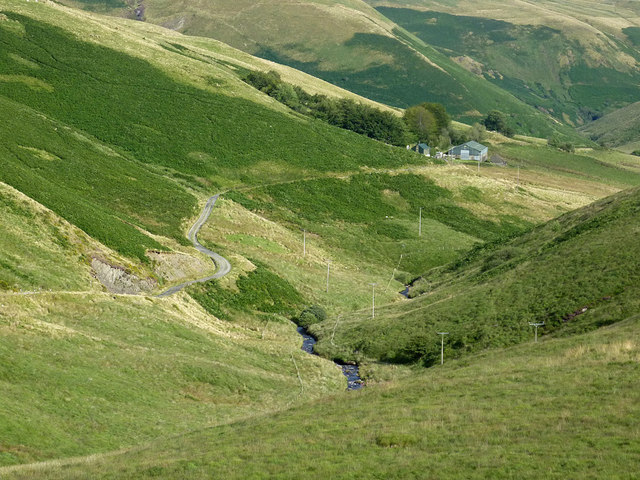
This is a telephoto assisted image from Blaendoethie, looking south-east towards the buildings at Ty'n Cornel. The hostel (open all year) is to the left of the two green sheds. The land is grazed by sheep, and a few Welsh Black cattle.
 Map © Crown Copyright")
TIP: Click the map for more Large scale mapping
- Grid Square
- SN7453, 124 images (more nearby 🔍)
- Photographer
- Roger D Kidd (more nearby)
- Date Taken
- Wednesday, 20 August, 2014 (more nearby)
- Submitted
- Tuesday, 26 August, 2014
- Subject Location
-
OSGB36:
 SN 7464 5370 [10m precision]
WGS84: 52:10.0371N 3:50.0604W - Camera Location
-
OSGB36: SN 7419 5391
- View Direction
- East-southeast (about 112 degrees)