SN7889 : New footbridge over Afon Rheidol - 13
taken 10 years ago, near to Banc Llechwedd-Mawr [hill or Mountain], Powys, Great Britain
Until the construction of Nant-y-moch reservoir in the 1950s, Afon Rheidol was considered to commence at the confluence of Afon Hengwm and Afon Hyddgen SN7806489292 and is marked as such on contemporary maps. The reservoir isolated this stretch of the Rheidol from the rest of the river, so the dilemma now is what is the name of the isolated stretch? Given the new situation, logically it should be called Afon Hengwm or perhaps Afon Hyddgen. Unfortunately the OS studiously avoids naming it on any scale of map.
Given that it was traditionally the Rheidol, that is the name I know it by.
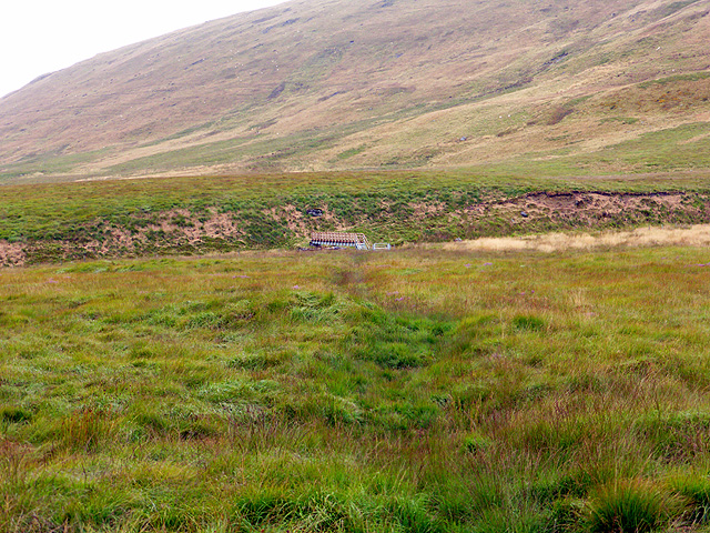
Since at least 1900, there has been a footpath from the now ruined farmstead of Nant-y-llyn SN7829589033 across the river by means of a ford and on to Lechwedd Mawr Farm SN7622388921 and beyond. It was not too bad to cross when water levels were low, but virtually impossible if water was at a moderate to high level. Fortunately, Ceredigion C.C. have resolved the problem by construction of the footbridge seen in the photos linked to this article.
 Map © Crown Copyright")
- Grid Square
- SN7889, 67 images (more nearby 🔍)
- Photographer
- John Lucas (more nearby)
- Date Taken
- Wednesday, 20 August, 2014 (more nearby)
- Submitted
- Tuesday, 26 August, 2014
- Subject Location
-
OSGB36:
 SN 780 891 [100m precision]
WGS84: 52:29.1746N 3:47.8153W - Camera Location
-
OSGB36: SN 781 890
- View Direction
- West-northwest (about 292 degrees)