2014
ST5772 : Gas Ferry Road (North)
taken 10 years ago, near to Clifton, Bristol, England
This is 1 of 2 images, with title starting with Gas Ferry Road in this square
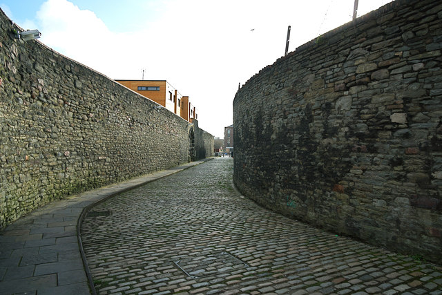
Gas Ferry Road (North)
Reminds us of when a ferry ran between the adjacent former Gas Works and the south bank of Bristol Harbour, where the road continues as Gas Ferry Road (South) alongside the SS Great Britain car park to Cumberland Road on the Avon New Cut. The old stone rubble walls are subject to a preservation order.
 Map © Crown Copyright")
TIP: Click the map for more Large scale mapping
- Grid Square
- ST5772, 2306 images (more nearby 🔍)
- Photographer
- Anthony O'Neil (more nearby)
- Date Taken
- Thursday, 27 February, 2014 (more nearby)
- Submitted
- Wednesday, 27 August, 2014
- Subject Location
-
OSGB36:
 ST 5795 7250 [10m precision]
WGS84: 51:26.9948N 2:36.3905W - Camera Location
-
OSGB36: ST 5796 7255
- View Direction
- South-southwest (about 202 degrees)