TQ5538 : Railway bridge over the Tunbridge Wells Circular Walk
taken 10 years ago, near to Langton Green, Kent, England
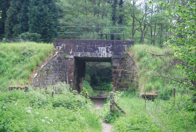
The Spa Valley Railway is a heritage railway opened in 1996. Running for 4 miles from Tunbridge Wells to Eridge, with Groombridge and High Rocks stations mid point. The line originally connected to the London, Brighton and South Coast Railway lines until it finally closed in May 1985 but in March 2011 the line was reconnected to Eridge and the main line to London.
Some of the original station buildings have now been converted to other uses, Tunbridge Wells a restaurant and Groombridge to offices.
A 27 mile circular walk around the town of Tunbridge Wells. The route was established in 1989 as part of the centenary celebrations of the town being granted the Borough Charter. There is no official start or end to the walk. The walk visits Southborough, Pembury, Frant, Eridge, Groombridge and Speldhurst as well as Eridge Rocks and Harrison Rocks. It is well signed along its entire length. As well as the main path there are four link paths from Tunbridge Wells and High Brooms stations to meet the path at Groombridge, Speldhurst, Southborough and Hawkenbury.
 Map © Crown Copyright")
- Grid Square
- TQ5538, 256 images (more nearby 🔍)
- Photographer
- N Chadwick (more nearby)
- Date Taken
- Saturday, 17 May, 2014 (more nearby)
- Submitted
- Friday, 29 August, 2014
- Subject Location
-
OSGB36:
 TQ 5571 3822 [10m precision]
WGS84: 51:7.3265N 0:13.4143E - Camera Location
-
OSGB36: TQ 5569 3823
- View Direction
- East-southeast (about 112 degrees)