2014
SN1300 : Ordnance Survey Flush Bracket (S7945)
taken 10 years ago, near to Tenby/Dinbych-y-Pysgod, Pembrokeshire/Sir Benfro, Wales
This is 1 of 2 images, with title starting with Ordnance Survey Flush Bracket in this square
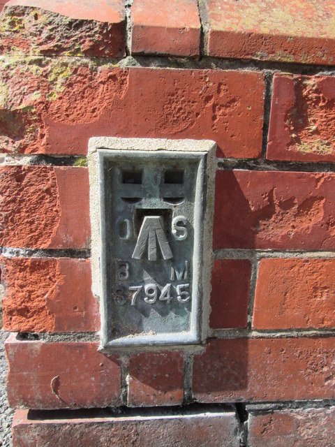
Ordnance Survey Flush Bracket (S7945)
This OS Flush Bracket can be found on a roadside wall of Avenue School. It marks a point 25.572m above mean sea level.
 Map © Crown Copyright")
TIP: Click the map for more Large scale mapping
- Grid Square
- SN1300, 1524 images (more nearby 🔍)
- Photographer
- Adrian Dust (more nearby)
- Date Taken
- Thursday, 28 August, 2014 (more nearby)
- Submitted
- Saturday, 30 August, 2014
- Subject Location
-
OSGB36:
 SN 1302 0064 [10m precision]
WGS84: 51:40.3997N 4:42.3337W - Camera Location
-
OSGB36: SN 1302 0064
- View Direction
- Northwest (about 315 degrees)