2014
SO8376 : Crown House (2), Bull Ring, Kidderminster
taken 10 years ago, near to Kidderminster, Worcestershire, England
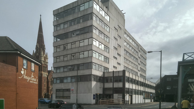
Crown House (2), Bull Ring, Kidderminster
A rear view of Crown House taken from Black Horse Lane. The building is supposed to due for demolition but at least two previous proposals to demolish it came to nothing, so only time will tell.
See also:- SO8376 : Crown House (1), Bull Ring, Kidderminster, and SO8376 : Crown House (3), Bull Ring, Kidderminster.
See also:- SO8376 : Crown House (1), Bull Ring, Kidderminster, and SO8376 : Crown House (3), Bull Ring, Kidderminster.
 Map © Crown Copyright")
TIP: Click the map for more Large scale mapping
- Grid Square
- SO8376, 883 images (more nearby 🔍)
- Photographer
- P L Chadwick (more nearby)
- Date Taken
- Saturday, 30 August, 2014 (more nearby)
- Submitted
- Sunday, 31 August, 2014
- Subject Location
-
OSGB36:
 SO 830 766 [100m precision]
WGS84: 52:23.2783N 2:15.0200W - Camera Location
-
OSGB36: SO 830 766
- View Direction
- East-northeast (about 67 degrees)