2014
TF4984 : Mablethorpe, St Mary's Church
taken 10 years ago, near to Mablethorpe, Lincolnshire, England
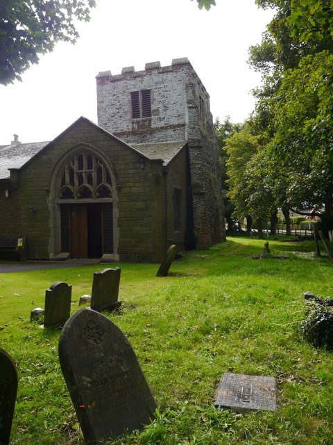
Mablethorpe, St Mary's Church
An entrance porch has been built on to the north face of the squat tower, possibly over a bench mark dating from the first primary levelling of England in the 1850s. See Link for details of the mark.
 Map © Crown Copyright")
TIP: Click the map for more Large scale mapping
- Grid Square
- TF4984, 51 images (more nearby 🔍)
- Photographer
- Brian Westlake (more nearby)
- Date Taken
- Sunday, 31 August, 2014 (more nearby)
- Submitted
- Monday, 1 September, 2014
- Subject Location
-
OSGB36:
 TF 4977 8454 [10m precision]
WGS84: 53:20.1942N 0:14.8718E - Camera Location
-
OSGB36: TF 4976 8455
- View Direction
- Southeast (about 135 degrees)