2014
TA1028 : Clarence Flour Mills, Hull
taken 10 years ago, near to Kingston Upon Hull, England
This is 1 of 4 images, with title Clarence Flour Mills, Hull in this square
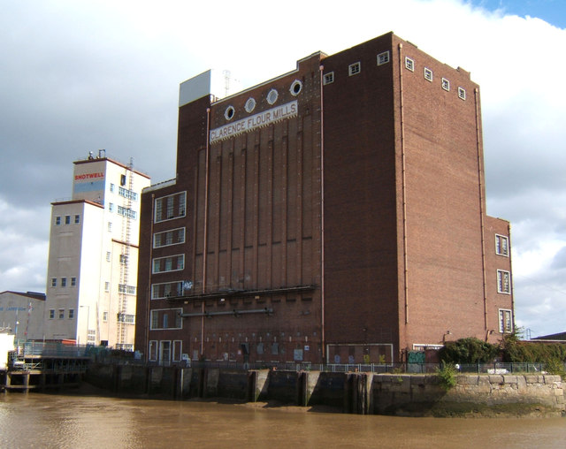
Clarence Flour Mills, Hull
Built for Rank Ltd in 1952 to replace buildings bombed during WW II. Now disused.
 Map © Crown Copyright")
TIP: Click the map for more Large scale mapping
- Grid Square
- TA1028, 3428 images (more nearby 🔍)
- Photographer
- JThomas (more nearby)
- Date Taken
- Saturday, 30 August, 2014 (more nearby)
- Submitted
- Tuesday, 2 September, 2014
- Subject Location
-
OSGB36:
 TA 103 289 [100m precision]
WGS84: 53:44.6989N 0:19.6743W - Camera Location
-
OSGB36: TA 103 288
- View Direction
- Northeast (about 45 degrees)